Bulbs
Flower Basics
Flower Beds & Specialty Gardens
Flower Garden
Garden Furniture
Garden Gnomes
Garden Seeds
Garden Sheds
Garden Statues
Garden Tools & Supplies
Gardening Basics
Green & Organic
Groundcovers & Vines
Growing Annuals
Growing Basil
Growing Beans
Growing Berries
Growing Blueberries
Growing Cactus
Growing Corn
Growing Cotton
Growing Edibles
Growing Flowers
Growing Garlic
Growing Grapes
Growing Grass
Growing Herbs
Growing Jasmine
Growing Mint
Growing Mushrooms
Orchids
Growing Peanuts
Growing Perennials
Growing Plants
Growing Rosemary
Growing Roses
Growing Strawberries
Growing Sunflowers
Growing Thyme
Growing Tomatoes
Growing Tulips
Growing Vegetables
Herb Basics
Herb Garden
Indoor Growing
Landscaping Basics
Landscaping Patios
Landscaping Plants
Landscaping Shrubs
Landscaping Trees
Landscaping Walks & Pathways
Lawn Basics
Lawn Maintenance
Lawn Mowers
Lawn Ornaments
Lawn Planting
Lawn Tools
Outdoor Growing
Overall Landscape Planning
Pests, Weeds & Problems
Plant Basics
Rock Garden
Rose Garden
Shrubs
Soil
Specialty Gardens
Trees
Vegetable Garden
Yard Maintenance
How Is a Land Survey Done?
How Is a Land Survey Done?. Land surveys are utilized to define boundaries for public or private land use. Determining land boundaries are essential to assigning appropriate parameters for purchasing or ownership of land parcels or dividing land in the public domain of the U.S. Government.
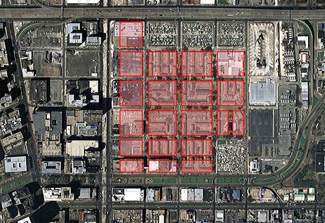
Land surveys are utilized to define boundaries for public or private land use. Determining land boundaries are essential to assigning appropriate parameters for purchasing or ownership of land parcels or dividing land in the public domain of the U.S. Government.
Land Survey Description
Land surveys are used in the construction process to assess boundaries for properties, topography for engineering designs and outline elevations for flood insurance for home sites, title for real estate transactions, subdivisions and other construction projects for a given area or assign government measurements to public land.
Global Positioning System
Surveys can use Global Positioning System (GPS) equipment to map precise points for a land survey. The GPS equipment can commonly been seen in use by surveyors on the side of the road and looks like a camera on a tripod. The receiver transmits signals from various points to a data collector for storage. The data is then downloaded to a computer and specialized software analyzes the data to map the exact position of the points within millimeters.
Traditional Total Station Surveying
Traditional total station surveying uses distance meters to measure distance and a theodolite, a mounted, optical telescopic instrument that rotates horizontally or vertically, to measure angles and compiles measurements into one instrument for analysis. A beam of infrared light is sent to a prism on a pole or tripod. Measurements are based on the travel time of the light to the return and the total station uses this number to calculate the distance away the prism is located.
Leveling And 3-D Surveying
Land elevations utilize leveling and 3-D surveying by calculating the elevation between two points on the ground. For the leveling method, the surveyor holds a ruler on the ground and visually sees how high above the ground the level is set and repeat this process at different points on the ground to determine elevation. For 3-D surveying, the total station surveying process and GPS method utilize geometry, and measures angles and distances from intersecting vectors coordinated by satellites in space.
Public Land Survey
The Public Land Survey System (PLSS) is used to subdivide in land in the United States that are part of public domain and owned by the federal government. PLSS is regulated by the U.S. Department of the Interior, Bureau of Land Management. Land that was originally part of public domain but now privately held, legal land descriptions are still written in the PLSS format.
PLSS surveys measure points from north, south, east and west. North and south points are called the Principal Meridian and 37 Principal Meridians are defined on various land surveys. East and west points are called a base line and are perpendicular to the Principal Meridian.
Land, called townships, are defined using the location north or south of the baseline and the location east or west of the Principal Meridian. Land not included in the PLSS surveys is military reservations, national parks or bodies of water.


